 Sign up with Google
 Sign in with Zoho


What if there was a way to confirm ownership, access and risk for any parcel in less than 5 minutes? In 2026 smarter research uses the combo of AI-powered filters plus smart research workflows to make property discovery easier. This guide shows how real estate investor management software and a free parcel map app work together to drastically reduce due diligence time and risk.
You will learn about core elements, advanced filters, processes and what to watch out for in this powerful property research tool.
What Is Smarter Land Research In 2026?
More intelligent land research in 2026 makes use of nationwide parcel data, AI-powered analytics, and centralized owner databases to enable faster decision-making. It serves as a decent alternative to time-consuming and inefficient per-county research by offering interactive visualization, extensive reporting, and immediate comparison tools to boost confidence and efficiency.
Core Pillars of Modern Land Due Diligence
Every profitable deal starts with due diligence. The four elements below represent the foundation of the accurate evaluation of any asset in 2026.
Ownership and Parcel Boundaries
Verified ownership is the single point of entry. By clicking on any parcel, the user gets access to the name, mailing address, acres owned, and boundaries on a convenient satellite view.
National-level data depth enables you to identify neighboring owners and discover portfolio owners to engage in high-level outreach.
Zoning, Access, And Road Frontage
The land’s permitted use is often governed by local zoning regulations. Before marketing or constructing, check municipal codes, including required setbacks and allowed improvements. In addition, analyze the parcel’s accessibility. Infill parcels can depreciate rapidly. By applying road frontage filters, you can identify legal access and potential easement requirements.
Environmental Filters That Matter
Environmental risk factors can make or break a deal. Zones of large bodies of water, wetlands, slopes, and other factors can influence potential use, insurance, and permits.
AI-generated slope reports as well as topographic layers can identify developable land. Steep slopes can lead to higher grading costs, as well as a decrease in developable square footage.
Market Value and Comparable Sales
Value is never a guessing game. With the right location, square footage, access, and recently sold properties, you can determine value in no time at all with the power of an AI.
Market search, hot sheets, and comparative market analysis ensure you get value back or you pay full price in a low-traffic area.
Why Real Estate Investor Management Software Is Critical in 2026
Modern investors have hundreds of leads. Spreadsheets can't keep up with the amount of information. Centralized software keeps owner reports, skip tracing information, and notes in one place for up to sixty days, or more. You can perform a single owner search or pull reports for hundreds of owners at once.
It also filters out undesirable land. Artificial intelligence land filters flag land-locked, flood-prone, swampy, and steep parcels before you waste time contacting them.
How To Use A Free Parcel Map App For Accurate Due Diligence
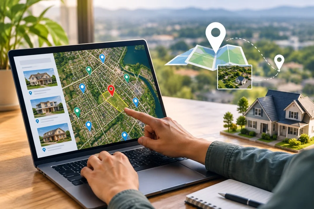
Mobile research has become a necessity. With an application, you can perform multiple tasks on site with the ability to view offline maps and parcel details. Ability to search by address or by placing a marker on the map to bring up lot details such as square footage, acreage, owners, and more within seconds.
Save job sites, take notes, and even take photos to share with your office. The time from research to report has never been shorter.
Advanced Workflow For Smarter Research In 2026
Use this proven workflow to research smarter and close faster in 2026.
- Step 1: Define Your Buy Box. Set parameters such as the desired acreage, state, road frontage, and maximum slope.
- Step 2: Apply AI Filters. Remove non-viable parcels using wetlands, flood zones, landlocked areas, and slope filters.
- Step 3: Verify Ownership And Title Signals. Conduct owner reports, back tax checks, and chain of title reviews.
- Step 4: Skip Trace and Outreach. Cost-effective bulk skip trace to obtain updated phone and email information on owners.
- Step 5: Analyze Value. Evaluate AI comp reports, market search, and heatmap data to determine your offer price with confidence.
- Step 6: Document Everything. Store maps, photos, and reports in one place for compliance and easy resale.
Common Mistakes To Avoid In Land Buying
Many new investors overlook environmental concerns or believe that they have access to something that they do not. This can lead to unbuildable lots or even legal issues.
Always confirm legal access, zoning, flood plains, and unpaid taxes. For a deeper breakdown, read this guide on common land buying mistakes and how to avoid them.
To Sum Up
Smarter land research in 2026 is all about speed, precision, and systematicity. The combination of powerful data layers with well-defined processes helps you keep and increase your profit margins.
Real estate investor management software combined with a free parcel map app for field use enables investors to close deals faster and with significantly reduced risk.
Land Portal is an example of such a platform that combines nationwide parcel data, powerful filters, and investor deal management tools into a single unified interface that dramatically accelerates the due diligence process while minimizing errors.
Frequently Asked Questions
What Is the First Step in Land Research?
A reliable parcel search typically begins with verifying the ownership details. Before diving into assessing its value or zoning, double-check the owner’s name, acreage, and boundaries.
How Do I Check If Land Is Buildable?
To ensure the land is buildable, confirm the zoning and availability of road frontage. Check the area’s slope, flood risk, and wetlands. Ensure utilities are accessible, and the septic system and soil conditions are viable.
What Makes Parcel Data Reliable in 2026?
The most reliable parcel search services combine county records with aerial views and cutting-edge AI verification.









.webp)