 Sign up with Google
 Sign in with Zoho

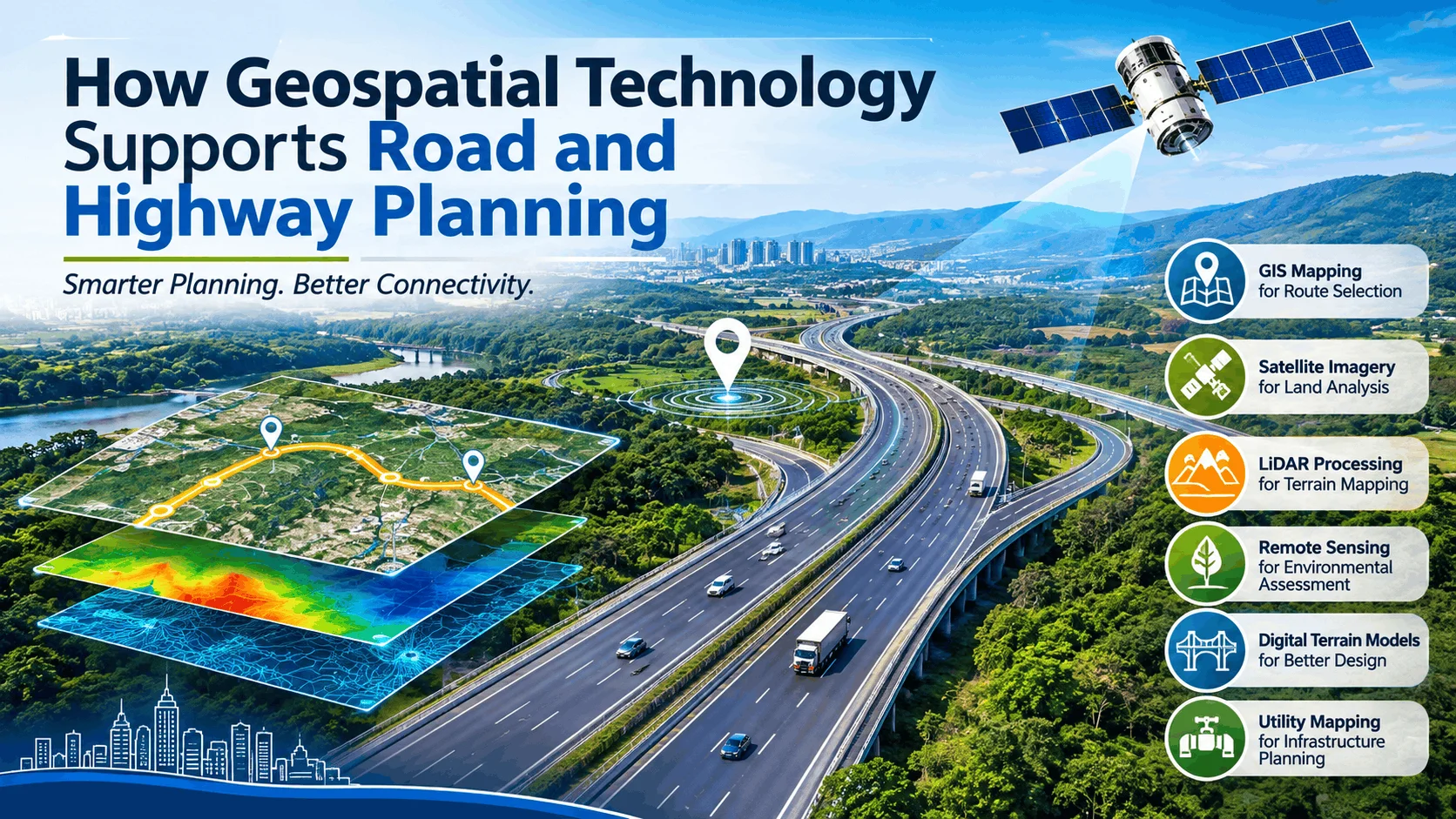
Roads and highways are essential for economic growth, transportation, and urban development. As cities expand and transportation demands increase, planning new roads and upgrading existing highway networks have become more complex.
Traditional surveying and mapping methods alone may not provide all the information required for large-scale infrastructure projects. Geospatial technology helps planners collect, analyse, and visualise geographical information to make better decisions throughout the road development process.
By combining Geographic Information Systems (GIS), satellite imagery, LiDAR data, remote sensing, and digital mapping, infrastructure teams can improve route selection, terrain assessment, land analysis, and construction planning.
Let's explore how geospatial technology supports modern road and highway planning.
1. GIS Mapping for Road Route Selection
Selecting the right road or highway alignment is one of the most important stages of infrastructure planning. A proposed route must consider existing roads, land ownership, settlements, rivers, forests, elevation, and other geographical features.
GIS mapping helps planners combine different spatial datasets into a single digital environment. By analysing these layers, project teams can compare alternative routes and identify suitable alignments.
GIS-based mapping supports:
- Identification of suitable road corridors.
- Analysis of existing road networks.
- Mapping of nearby settlements and infrastructure.
- Identification of geographical restrictions.
- Comparison of alternative route alignments.
This approach helps planning teams evaluate different possibilities before moving forward with detailed engineering and construction activities.
Related service: DSM Soft Geospatial Mapping Services
2. Satellite Imagery Processing for Land and Site Analysis
Before starting a road construction project, understanding the surrounding landscape is essential. Satellite imagery provides a broad view of geographical areas and helps planners identify existing land features.
However, raw satellite images require processing to make them suitable for detailed analysis. Image processing techniques such as orthorectification, georeferencing, mosaicking, and image enhancement help prepare accurate spatial datasets.
These processed images can support:
- Identification of land-use patterns.
- Monitoring of urban expansion.
- Analysis of vegetation and water bodies.
- Identification of changes in the surrounding environment.
- Preliminary assessment of proposed road corridors.
Satellite imagery also helps project teams understand how geographical conditions change over time, supporting better infrastructure planning.
Related service: DSM Soft Image Processing Services
3. LiDAR Processing for Terrain and Elevation Analysis
Terrain conditions have a major influence on road and highway construction. Hills, valleys, slopes, and uneven ground can affect road alignment, drainage design, and construction requirements.
LiDAR (Light Detection and Ranging) technology uses laser pulses to capture detailed three-dimensional information about the Earth's surface.
The collected LiDAR data is processed into point clouds, Digital Terrain Models (DTMs), and Digital Surface Models (DSMs). These datasets help engineers understand ground elevations and surrounding physical features.
LiDAR processing supports:
- Terrain and elevation analysis.
- Contour generation.
- Slope and gradient assessment.
- Identification of natural and man-made features.
- 3D terrain visualisation.
Accurate terrain information helps engineering teams evaluate geographical challenges and make informed decisions during the planning stage.
Related service: DSM Soft Geo Terrain and LiDAR Processing Services
4. Remote Sensing for Environmental Assessment
Road and highway development can affect forests, agricultural land, water bodies, and natural habitats. Understanding these environmental conditions is important when evaluating proposed infrastructure routes.
Remote sensing uses satellite and aerial imagery to collect information about the Earth's surface without direct physical contact.
Through image classification and change detection, planners can identify different land-cover categories and monitor environmental changes.
Remote sensing applications include:
- Land-use and land-cover classification.
- Vegetation and forest monitoring.
- Water body identification.
- Environmental change detection.
- Monitoring of construction-related landscape changes.
These insights can support environmental assessments and help planning teams understand the potential impact of proposed road development.
5. Digital Terrain Models for Better Highway Planning
Elevation differences and ground conditions play an important role in highway design. Engineers need reliable terrain information to understand how a proposed road will interact with the surrounding landscape.
Digital Terrain Models represent the bare-earth surface, while Digital Surface Models include buildings, vegetation, and other above-ground features.
These models help project teams understand:
- Ground elevation and terrain variations.
- Contours and slope conditions.
- Potential drainage challenges.
- Changes in surface elevation.
- Surrounding terrain characteristics.
By using accurate elevation datasets, engineering teams can improve their understanding of site conditions before detailed design and construction.
6. Utility Mapping and Existing Infrastructure Identification
Road expansion and highway construction projects often involve existing underground and above-ground infrastructure, including water pipelines, electrical networks, drainage systems, and telecommunications cables.
GIS-based utility mapping helps organise infrastructure information geographically. It allows project teams to visualise existing utility networks and understand their relationship with proposed road corridors.
Accurate utility information can support infrastructure coordination, reduce the risk of unexpected conflicts, and improve project planning.
Related service: DSM Soft Utility Network Information System
7. The Future of Geospatial Technology in Road Development
Geospatial technology continues to evolve with advancements in artificial intelligence, automation, cloud computing, and 3D visualisation.
The integration of GIS, satellite imagery, LiDAR, and remote sensing creates opportunities for more detailed spatial analysis and improved infrastructure planning workflows.
As road networks become more complex, accurate geospatial datasets will continue to play an important role in supporting transportation planning, infrastructure development, and asset management.
How DSM Soft Supports Geospatial Mapping Projects
At DSM Soft, geospatial technology and data processing capabilities support a wide range of mapping and infrastructure-related requirements.
Our geospatial services include:
- Mapping Services
- Geo Terrain-Based Services
- Satellite and Aerial Image Processing
- LiDAR and RADAR Processing
- Remote Sensing and Change Detection
- GIS Design and Development
- Utility Network Information Systems
With experience in geospatial data processing and mapping workflows, DSM Soft supports organisations that require structured and accurate spatial information for their projects.
Conclusion
Geospatial technology has become an important part of modern road and highway planning. From identifying suitable routes and analysing terrain conditions to monitoring environmental changes and mapping existing infrastructure, spatial data provides valuable information throughout the planning process.
By combining GIS mapping, satellite imagery processing, LiDAR, and remote sensing, infrastructure teams can better understand geographical conditions and support more informed planning decisions.
As transportation infrastructure continues to develop, geospatial technology will remain an important tool for building better-connected and well-planned road networks.
Learn more about DSM Soft's Geospatial Solutions: https://dsmsoft.com/Geospatial.aspx